Atlantic Tropical Development: How Storms Form and What to Expect
Ever wonder why the Atlantic seems to churn out so many storms every summer? It’s not magic – it’s a mix of warm water, humidity, and wind patterns that team up to spin up tropical cyclones. In plain words, when the ocean heats up, the air above it rises, pulls in more warm air, and a vortex can start to grow. That vortex may become a tropical depression, then a storm, and if conditions stay sweet, a full‑blown hurricane.
Key Factors That Drive Storm Formation
The first piece of the puzzle is sea‑surface temperature. Waters above 26 °C (about 79 °F) provide the energy a storm needs to keep growing. During the Atlantic hurricane season—June through November—the Gulf Stream and Caribbean Sea often hit those temps, giving storms a big boost.
Second, you need low wind shear. Think of wind shear as a set of scissors that can slice a storm apart. When upper‑level winds are gentle and line up with lower‑level winds, the storm’s core stays intact and can intensify. High shear, on the other hand, blows the system apart before it gets a chance to strengthen.
Third, moisture matters. A moist mid‑level atmosphere acts like fuel, keeping the storm’s thunderstorm clouds alive. Dry air can choke the system, causing it to weaken or die off.
Finally, a pre‑existing disturbance—like a tropical wave traveling off Africa—often serves as the seed. If that wave meets warm water, low shear, and plenty of moisture, the whole process kicks into gear.
Tracking the Cycle and Staying Safe
Once a system forms, scientists use satellites, buoys, and aircraft to keep tabs on it. They watch the central pressure, wind speed, and movement. A drop in pressure usually means the storm is tightening and getting stronger. If the storm starts moving westward toward the Caribbean or the U.S. Gulf Coast, watches and warnings are issued.
For everyday people, the best move is to stay informed. Sign up for local alerts, check the National Hurricane Center’s forecasts, and know your evacuation routes. Even if a storm looks weak now, it can flare up quickly once it moves over warmer water.
Preparation doesn’t have to be a big production. Keep a few gallons of water, a flashlight, extra batteries, and a basic kit of meds and non‑perishable food. If you live in a flood‑prone area, think about a sandbag barrier or a portable pump.
Remember, most Atlantic storms never become hurricanes. Many fizz out over the open ocean or make landfall as a tropical depression, bringing rain but limited wind damage. Understanding the ingredients—warm water, low shear, moisture, and a seed disturbance—helps you gauge how serious a system might become.
So next time you see a swirl on the radar, ask yourself: Is the water warm enough? Is the wind shear low? Is the air moist? If the answer is yes, keep an eye on that system and be ready to act. Simple awareness can keep you safe when the Atlantic turns up the heat.
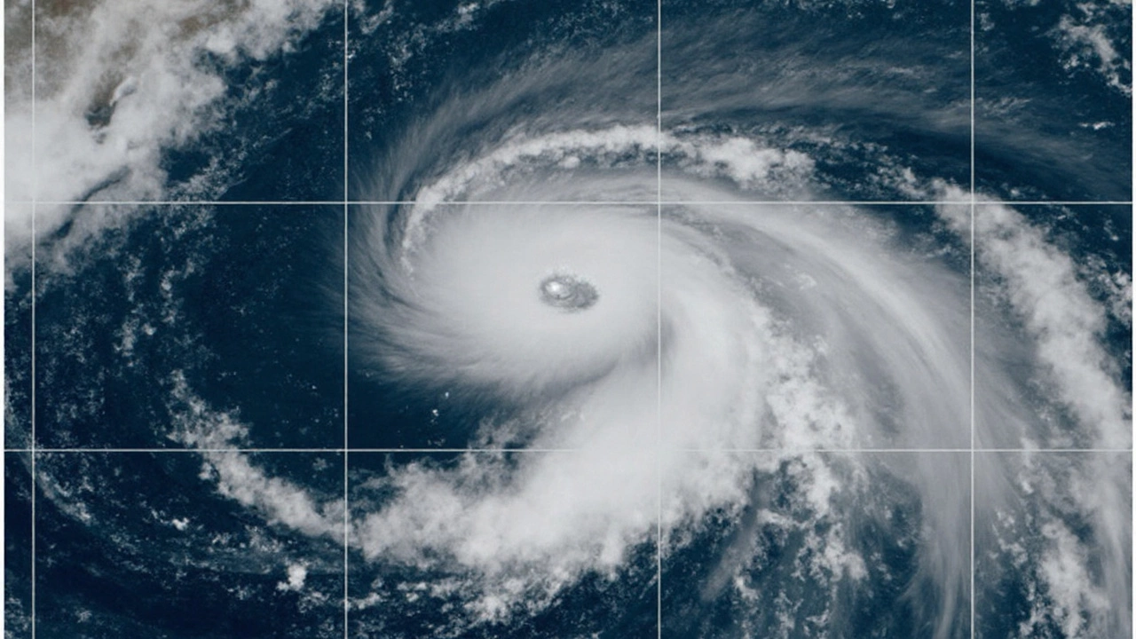
Hurricane Gabrielle Explodes to Category 4 as New Atlantic Storms Brew
- Thomas O'Reilly
- Sep 24 2025
- 0 Comments
The storm surged to Category 4 strength with 140‑mph winds east‑southeast of Bermuda after a rapid intensification phase. Originating from an African tropical wave, it has maintained its power while heading east‑northeast. Forecasters also note two fresh tropical disturbances forming behind it, raising U.S. landfall concerns as October nears.
View More